
Latest News
Back to Articles

.jpg)
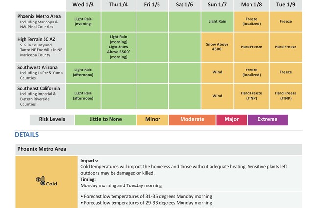
A cold front will move through this afternoon and evening with a brief period of light rain showers expected. Very light snow will be possible above 5500 feet north and east of Phoenix tonight.
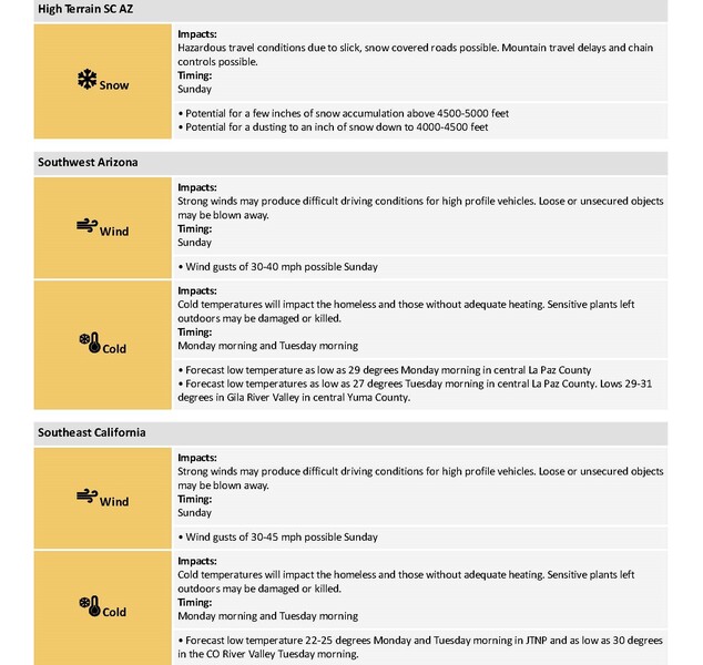
A colder weather system for Sunday may lead to a few inches of snow above 4500-5000 feet, windy conditions in SE CA and SW AZ, and light rainfall mainly for Arizona lower deserts.
Freezing temperatures likely for portions of the area Monday and more widespread freezing temperatures Tuesday morning.
CHANGES FROM PREVIOUS BRIEFING
Lowered potential snow impacts on Sunday to minor
WEATHER RISK OUTLOOK
Risk levels incorporate potential impacts from weather hazards and likelihood of occurrence. The weather hazard with the greatest risk wilbe listed first in the matrix.
FOR MORE INFORMATION
For the latest forecast updates, visit weather.gov/phoenix
.
.jpg)